Map Editor Plugins - Graticule Layer
|
Installation Feature LayerStyles Effects Drop Shadow |
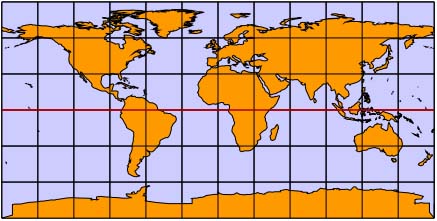
The graticule layer is a special layer type which draws a graticule over the Earth's surface. In its Properties dialog you can turn on a number of features for it to draw as well as changing the colours. Features include:
You will often use two graticule layers: one at the back with a filled frame to provide shading for the sea and one at the top to draw grid lines.
The World with two graticules
|